


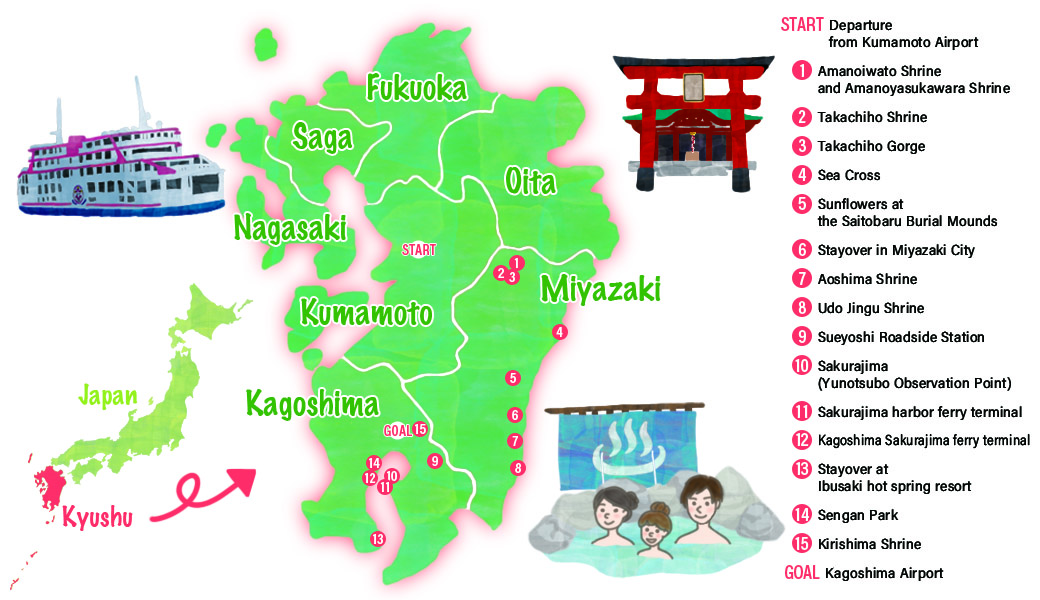
Recommend Drive Course
Departure from Kumamoto AirportRenting cars
Approximately 1 hour 30 minutes
MapCode:330 837 639*52
These shrines appear in Japanese mythology and enshrine the Amanoiwa (heavenly rock cave), a cave where the goddess Amaterasu is said to have hidden, as a sacred object of worship. Visitors can view the Amanoiwa cave after registering at the temple office. About 10 minutes on foot from Amanoiwato Shrine, Amanoyasukawara Shrine is a cave where the all the deities are said to have gathered when Amaterasu hid in the cave.
Approximately15 minutes
MapCode:330 741 348*05
Built approximately 1900 years ago, of the 88 shrines in the Takachiho Gorge, this is the one shrine where several gods are enshrined. The main building of the shrine and the pair of iron guardian dogs (collection) said to have been presented by Minamoto no Yoritomo and are government-designated Important Cultural Properties.
Approximately 5 minutes
MapCode:330 711 699*41
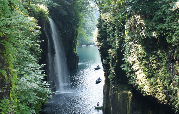
Formed by errosion of solidified pyroclastic from during an eruption of Mount Aso in ancient times, the towering cliffs of the gorge extending some seven kilometers present an impressive sight. Visitors can enjoy the sight of the cliffs that tower some 80 to 100 meters and the waterfall at close quarters from rental boats.
Approximately 1hour 20 minutes
MapCode:136 291 648*50
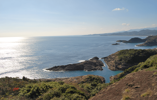
A cross carved into the surrounding rocks by erosion by the sea can be seen from the observation platform, and it is said that the sea here grants wishes.
Approximately 1 hour
MapCode:219 092 750*76
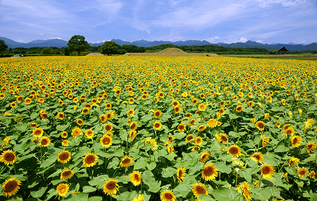
300 burial mounds are located on the expansive plateau 2.6 kilometers east to west 4.2 kilometers north to south. From mid-July to mid-August, visitors can enjoy the sight of about one million sunflowers in bloom around the burial mounds.
Approximately 50 minutes
MapCode:66 292 424*67
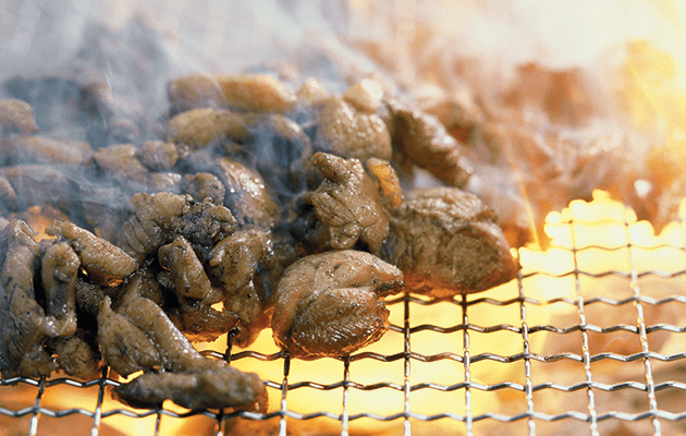
Dinners of well-known Miyazaki dishes such as fried chicken with vinegar and tartar sauce and grilled free-range chicken on skewers are recommended. Products made from mangos are standard souvenirs.
Approximately 30 minutes
MapCode:843 190 201*45
Aoshima can be seen offshore from the Aoshima Beach in south of Miyazaki City. The shrine grounds cover the entire island with the shrine itself located more or less at the center. The whole is surrounded by wavelike rock formations called "the devil's washboard," giving the island a mysterious atmosphere. The island is a well-known spot for forming relationships.
Approximately 35 minutes
MapCode:274 536 279*46
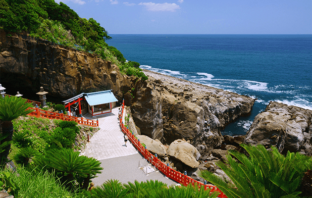
A rarity in Japan, the main building of the shrine is located in a cave at the tip of Udozaki, a cape that projects into the bright green sea at Miyazaki Nichinan. Untama, lucky pebbles can be bought here for 100 yen. Men and women pray and throw the Untama, men with the left hand and women with the right, and it is said that their prayers will be answered if the Untama falls into a hollow on a square-shaped rock called "Turtle Rock."
Approximately 1 hour 30 minutes
MapCode:216 386 170*70
This roadside station where visitors can enjoy a meal and shopping is provided with facilities such as a corner selling local produce and specialties and a restaurant with a popular lunchtime buffet.
Approximately 1 hour 15 minutes
MapCode:42 015 597*54
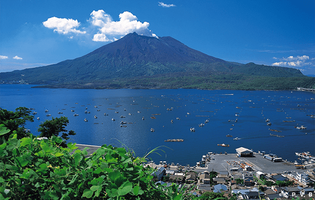
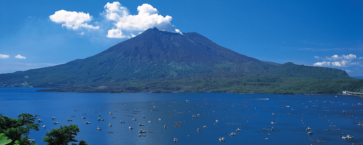
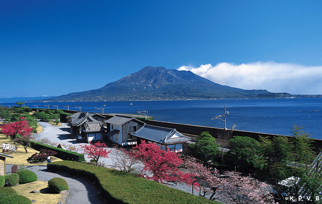
Symbol of Sakurajima, a volcano that is still active and continues to pour out ash. The Yunohira Observation Point is the best location on Sakurajima accessible to ordinary people. Evening is the best time, when visitors can watch the sunset over the sea and the surface of Mount Sakurajima colored with the rays of the setting sun.
Approximately 15 minutes
MapCode:42 012 480*05
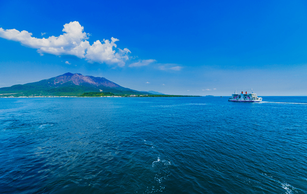
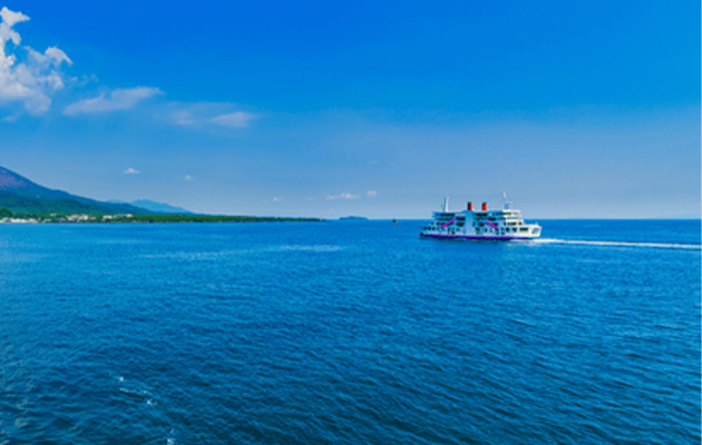
Linking the Sakurajima and Kagoshima harbors, the ferry service is available year-round 24 hours a day. In the mornings and evenings, the ferry runs every 15 minutes.
Approximately 15 minutes by ferry
Linking the Sakurajima and Kagoshima harbors, the ferry service is available year-round 24 hours a day. In the mornings and evenings, the ferry runs every 15 minutes.
Approximately 1 hour 30 minutes
MapCode:285 228 135*84
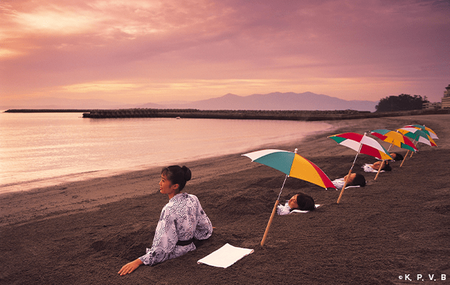
Popular hot spring sightseeing area in Kagoshima Prefecture. In the the famous steaming-sand hot spring at Ibusuki Hot Spring Resort, visitors lie face up on the sand and are then covered with sand heated to about 50 - 55 degrees Celsius. This is said to refresh the body by making the entire body sweat and promoting blood circulation.
Approximately 1 hour 30 minutes
MapCode:42 099 681*38
Stately home of the daimyos (feudal lords) of the Shimazu family who governed Kagoshima (Satsuma). As well as the superb scenery of a miniature mountain representing Sakurajima and a pond representing Nishiki Bay, visitors can enjoy seasonal flowers blooming in the gardens. In 2015, the gardens were registered as one of the "Sites of Japan's Meiji Industrial Revolution."
Approximately 1 hour 10 minutes
MapCode:376 089 594*51
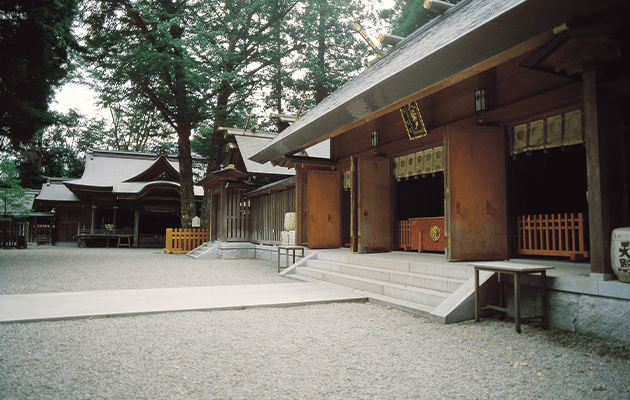
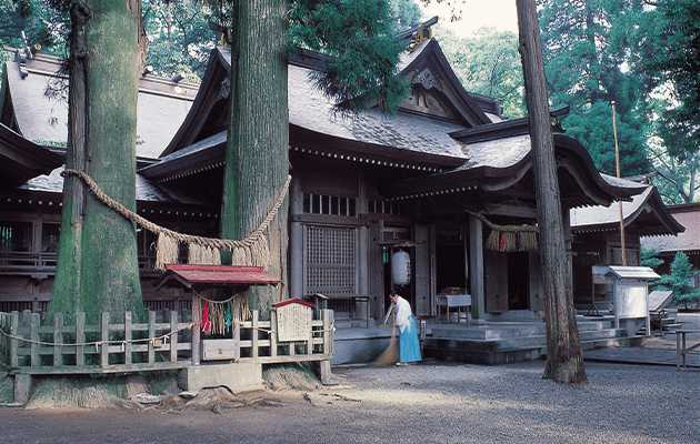
Said to have been built in the sixth century, this historic shrine was relocated to its current site approximately 500 years ago after being rebuilt a number of times following repeated destruction by eruptions of Mount Kirishima. With the 800-year old sacred tree and boulders formed from gravel and sediment, the shrine is a well-known power spot.
Approximately 40 minutes
MapCode:42 776 823*27
Kagoshima AirportRental car return
Details such as times required are rough guides. Please be sure to check map codes of destinations before setting out. The site accepts no responsibility whatsoever for any disadvantages or damages arising from use of the site