


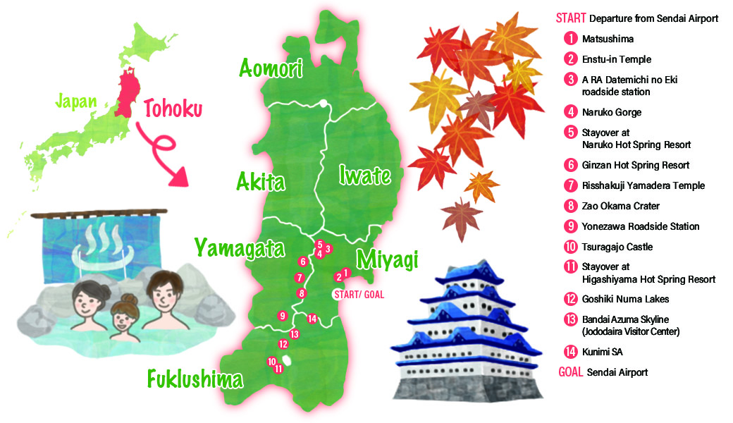
Recommend Drive Course
Departure from Sendai AirportRenting cars
Approximately 40 minutes
MapCode:110 443 066*40
The typical picturesque Japanese scenery of approximately 260 small islands can be viewed from spots at high elevations as well as sightseeing boats, where visitors can enjoy the beautiful sights that change with the sunrise and sunset.
Approximately 10 minutes on foot
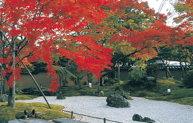
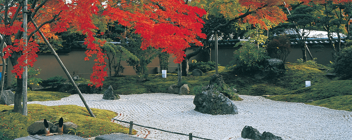
The beautiful photogenic scenery of the gardens changes with the seasons with trees adorned in autumn colors and the color of garden moss.
Approximately 1 hour 10 minutes
MapCode:317 745 492*00
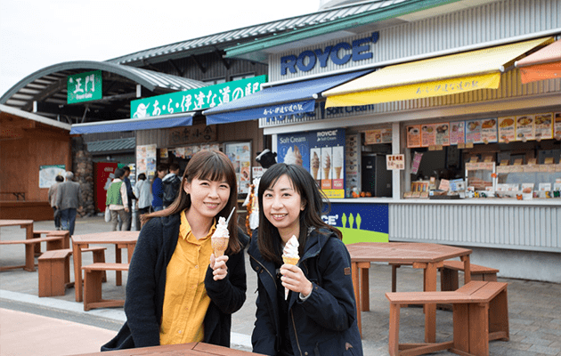
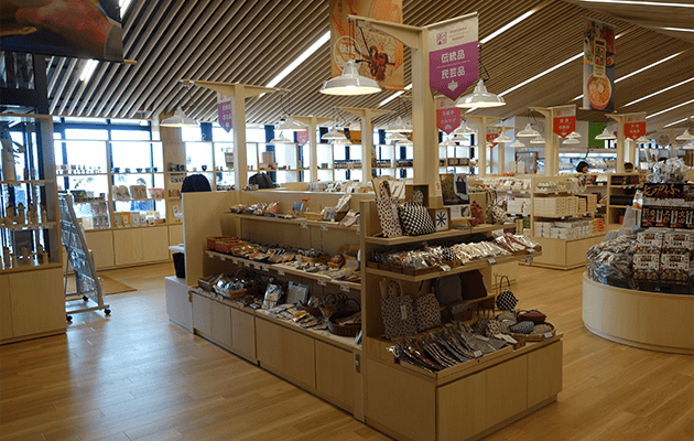
One of best roadside stations in Tohoku, this is a popular facility with visitors. One of the attractions is that this is the only store in Honshu under direct management of ROYCE.
Approximately 30 minutes
MapCode:317 817 059*17
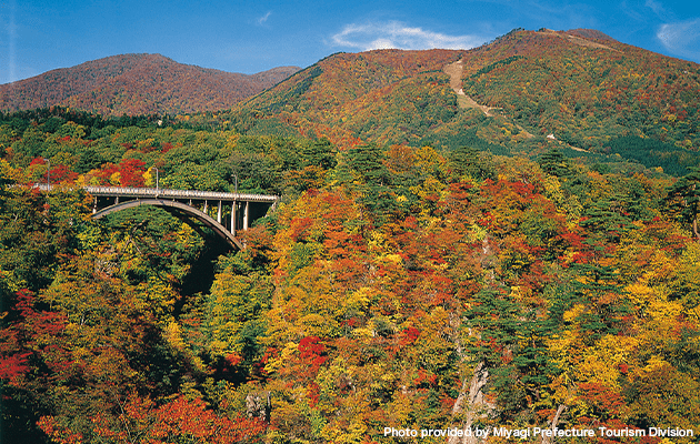
The vast 100 meter-deep ravine extends for some 2.5 kilometers. In an average year, the entire mountain is covered in the vivid colors of trees adorned in autumn colors from mid-October to early November.
Approximately 15 minutes
MapCode:317 851 760*64
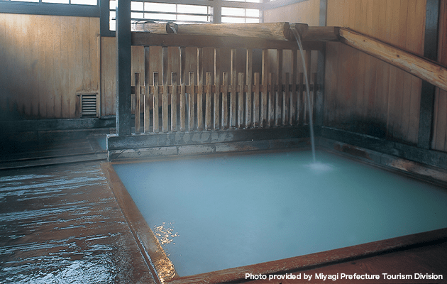
This is a hot spring area with a history spanning more than 1,000 years. With a wide range of hot spring types, nine of the eleven types in Japan can be found here, making this a hot spring spot popular from olden days.
Approximately 1 hour
MapCode:720 858 344*63
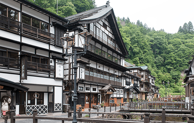
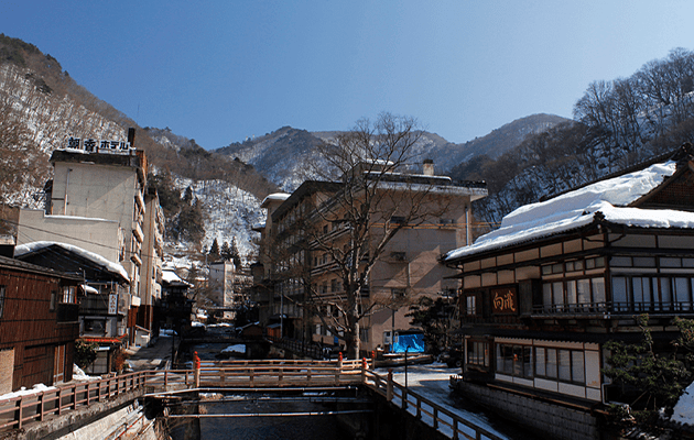
Nostalgic hot spring village with wooden inns along the riversides. Visitors can also enjoy relaxing with their feet on footbaths and strolling around the souvenir shops.
Approximately 1 hour 10 minutes
MapCode:62 232 088*03
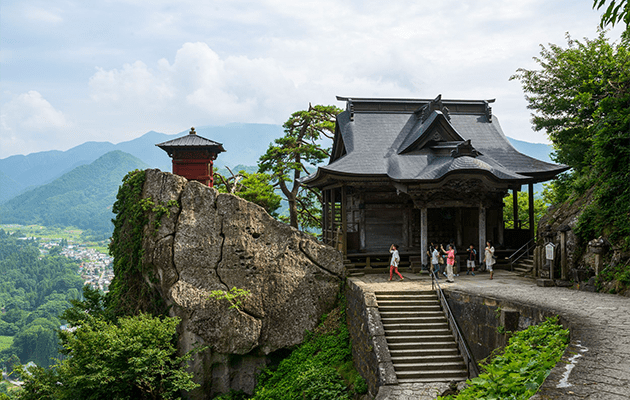
Sacred mountain with numerous temples built here and there on the cliffs. Visitors can enjoy the solemn atmosphere of the temples as they climb the 1,000 steps from the temple gate. The view from the five-storey pagoda built on the cliff gives one the feeling of floating in the air.
Approximately 1 hour 20 minutes
MapCode:569 428 868*48
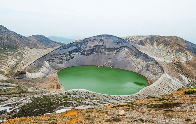
Round crater lake the name of which derives from the resemblance of the crater to a traditional cooking pot. The emerald green lake surface and the rough crater form a magnificent sight. Early November to late April in an average year: Sightseeing is not possible during the winter when access is closed.
Approximately 1 hour 10 minutes
MapCode:127 016 324*18
As well as a restaurant where visitors can enjoy Yonezawa brand beef, the station also has shops where local specialties can be bought.
Approximately 1 hour 30 minutes
MapCode:97 261 171*52
Tsuragajo Castle with its red-tile roof and the beautifully lit-up autumn colors of the trees produce a scene with a magical atmosphere.
Approximately 15 minutes
MapCode:97 205 867*12
Said to have been discovered some 1,300 years ago, this hot spring resort is also a good spot to use as a base for sightseeing in Aizu. The Japanese-style inns standing along the river banks create a hot-spring atmosphere.
Approximately 1 hour
MapCode:413 566 067*52
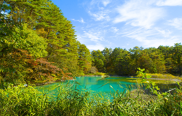
Group of lakes to the north of Mount Bandai, a well-known mountain in Fukushima. The mysterious colorful azure, blue and green ponds each present a different appearance.
Approximately 1 hour
MapCode:475 180 388*42
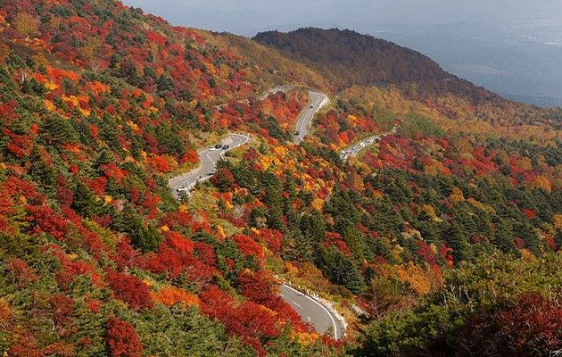
1,350 meters above sea-level, with its magnificent scenery, the road is called "the road through the sky." The driving course can be enjoyed year-round with beautiful colored foliage in autumn and snow corridors in spring.
Approximately 1 hour
MapCode:76 564 471*38
Here, visitors can take a break before the long tiring trip back. Visitors can also purchase local specialties and souvenirs at places such as service areas on the expressway.
Approximately 1 hour
MapCode:21 200 373*62
Sendai AirportRental car return
Details such as times required are rough guides. Please be sure to check map codes of destinations before setting out. The site accepts no responsibility whatsoever for any disadvantages or damages arising from use of the site