


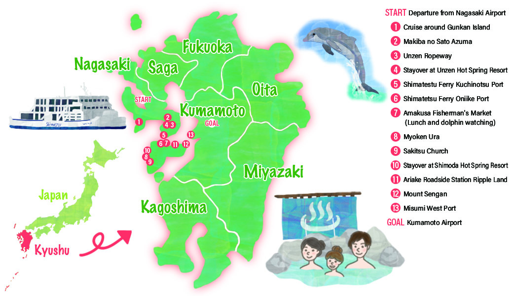
Recommend Drive Course
Departure from Nagasaki AirportRenting cars
Approximately 45 minutes
MapCode:443 884 206*22
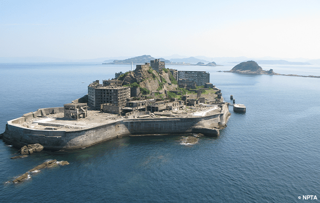
Although flourishing as an undersea coal mining island after the war, the island became uninhabited with closure of the mine in 1974, when the main source of energy changed to petroleum. The name of the island, "Gunkan," derives from the resemblance of its exterior with its high-rise reinforced concrete walls to a battleship (Gunkan in Japanese). The island was registered as a World Heritage Site in 2015. Now accessible to ordinary people, many companies operate tours of the island.
Approximately 1 hour 10 minutes
MapCode:173 761 394*22
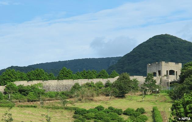
The expansive ranch in the mountains gives a panoramic view of the beautiful scenery of the Ariake Sea. The ranch also has attractions such as a 480-meter long promenade modeled on the Great Wall of China.
Approximately 50 minutes
MapCode:173 589 616*02
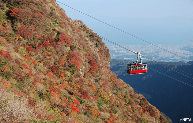
Visitors can ascend Mount Myoken, standing 1,333 meters above sea level, on the ropeway and enjoy a walk in the fresh mountain air as they take in the sights of seasonal blooms such as camelias in spring, fresh greenery in summer, the changing color of leaves in autumn and silver frost in winter.
Approximately 15 minutes
MapCode:173 556 557*36
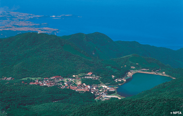
The first designated national park in Japan, Unzen is an international sightseeing spot that has long been a destination for visitors from overseas. Here, visitors can enjoy sights such as Unzen Jigoku with its impressive plumes of rising steam and the scenic hot spring town.
Approximately 35 minutes
MapCode:173 067 858*17
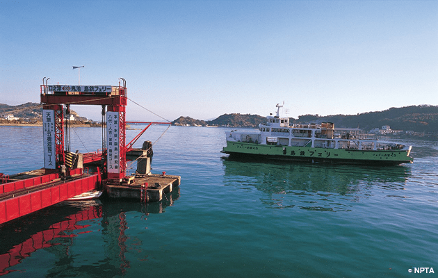
Visitors can travel from Kuchinotsu Port in the Shimabara Peninsula to Oniike Port in Amakusa by ferry. The trip takes approximately 30 minutes.
Approximately 30 minutes by ferry
Visitors can travel from Kuchinotsu Port in the Shimabara Peninsula to Oniike Port in Amakusa by ferry. The trip takes approximately 30 minutes.
Approximately 5 minutes
MapCode:254 721 786*12
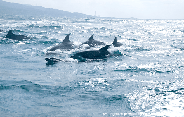
After enjoying an early lunch at the Amakusa Fisherman's Market where freshly caught seafood unique to Amakusa is available, visitors can enjoy watching bottlenose dolphins that live in the seas of Amakusa.
Approximately 40 minutes
MapCode:474 525 153*87
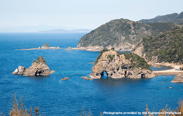
Myoken Ura is a popular scenic spot on the west coast of Amakusa with cliffs along the beach where visitors can enjoy the wonderful natural beauty. The area is also a popular scuba diving spot.
Approximately 20 minutes
MapCode:474 228 071*85
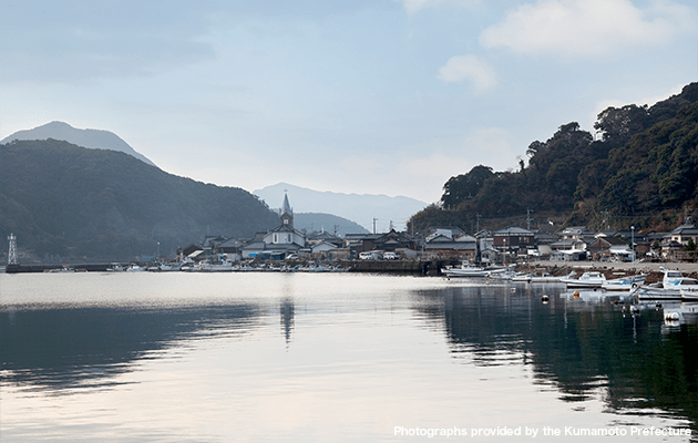
Also known as "Tenshudo Temple," this is one the churches where "secret Christians" maintained their faith amid severe oppression. The scenery here has also be selected as a "government-designated Important Cultural Landscape," while the "Amakusa Sakitsu Village" is a World Heritage Site.
Approximately 50 minutes
MapCode:474 616 343*02
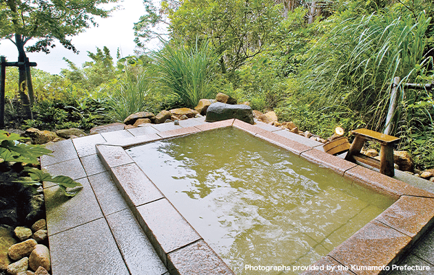
This hot spring resort is the perfect spot to watch the sunset over the Amakusa West Coast, designated as One of Japan's 100 Most Beautiful Sunsets.
Approximately 30 minutes
MapCode:254 621 209*71
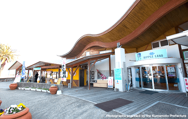
With facilities such as a shop selling local produce from Amakusa and a restaurant the serves dishes using local ingredients, this is a lively roadside station bustling with people. The station also offers a wide range of products and menus featuring octopus, a specialty of Ariake town.
Approximately 20 minutes
MapCode:372 606 750*22
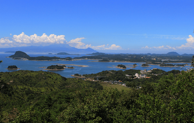
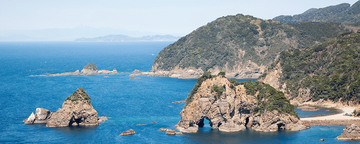
From the summit at some 162 meters above sea level, visitors can look out at beautiful sights such as the large and small islands of Amakusa, Unzen, Shimabara and the Yatsushiro Sea. With features such as strangely and fantastically-shaped rocks, this spot is also a designated National Site of Scenic Beauty.
Approximately 30 minutes
MapCode:677 130 122*33
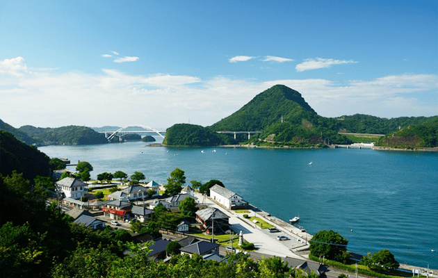
This is one of three major ports built during the Meiji era (1868 - 1912) by mountain cutting and land reclamation based on the unification of the country and promotion of production by the Meiji government. The port is highly regarded as an asset contributing to the World Heritage "Sites of Japan's Meiji Industrial Revolution."
Approximately 1 hour 15 minutes
MapCode:29 628 064*71
Kumamoto AirportRental car return
Details such as times required are rough guides. Please be sure to check map codes of destinations before setting out. The site accepts no responsibility whatsoever for any disadvantages or damages arising from use of the site